Advertisement
Grab your lab coat. Let's get started
Welcome!
Welcome!
Create an account below to get 6 C&EN articles per month, receive newsletters and more - all free.
It seems this is your first time logging in online. Please enter the following information to continue.
As an ACS member you automatically get access to this site. All we need is few more details to create your reading experience.
Not you? Sign in with a different account.
Not you? Sign in with a different account.
ERROR 1
ERROR 1
ERROR 2
ERROR 2
ERROR 2
ERROR 2
ERROR 2
Password and Confirm password must match.
If you have an ACS member number, please enter it here so we can link this account to your membership. (optional)
ERROR 2
ACS values your privacy. By submitting your information, you are gaining access to C&EN and subscribing to our weekly newsletter. We use the information you provide to make your reading experience better, and we will never sell your data to third party members.
Environment
Googling Air Pollution
Sensors: Tech companies and researchers team up to map air quality
by Matt Davenport
October 1, 2015
| A version of this story appeared in
Volume 93, Issue 39

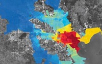
Aclima, a start-up company that develops sensor networks, has partnered with Google and EPA to roll out an unprecedented fleet of mobile air quality monitors in Los Angeles, San Francisco, and California’s Central Valley.
Although these monitors boast some of the latest sensor technology, they’ll still be familiar to many: They’re the same vehicles Google uses to capture photos for its popular Street View feature in Google Maps.
“Our goal is to create a new class of data that will be made available to communities, scientists, and air quality experts—as well as on Google Earth and Google Maps,” Aclima CEO and cofounder Davida Herzl tells C&EN.
Although California already has dozens of air monitoring stations, their stationary nature prevents them from creating detailed street-level maps of air quality, especially in urban areas where pollutant concentrations can vary greatly block to block.
The mobile monitors will carry sensor arrays to measure multiple pollutants, including soot, ozone, and nitrogen oxide gases (NOx). The company has adapted state-of-the-art commercial sensors to meet its needs, but it’s also working with research partners to bring brand-new technology to its arsenal, Herzl says.
The current fleet will provide useful data, especially for showing what people are exposed to as they drive, says Barbara J. Finlayson-Pitts, an atmospheric chemist at the University of California, Irvine, who is not involved with the project.
“You want to know in real time, and in real places, what people are exposed to,” she tells C&EN. “It’s hard to extrapolate that from stationary monitors.”
But roadway measurements may not capture everything. For example, NOx emitted by vehicles interacts with ozone, meaning the pollution profile measured by a car’s sensor will differ from conditions off the streets, Finlayson-Pitts explains.
“This platform is a good first start,” she says. “But it’s not going to solve all our problems immediately.”
The platform will, however, provide new data to better inform air quality models and forecasts, Herzl says. “This gets us unequaled spatial coverage.”


Join the conversation
Contact the reporter
Submit a Letter to the Editor for publication
Engage with us on Twitter